A site troubleshooting exercise was conducted in the week of 23rd May and these were the main challenges discovered to be hindering the collection of GPS data by CHWs:
Location setting
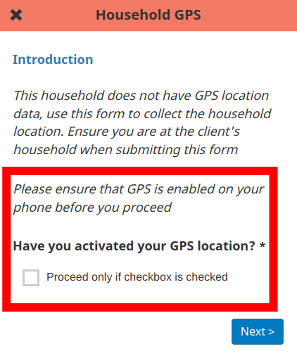
Some CHWs were discovered to navigate to GPS data collection forms and attempt to obtain GPS coordinates while the device location setting was off. This is despite a message on the first page of the form instructing the CHW to “ensure GPS is enabled on your phone before proceeding” and having to confirm this is done by activating a checkbox. See the screenshot below:
Mitigation measures:
- Improve instruction design - Devices normally have a location setting not a GPS setting. Using more specific language would help users create a direct association between the form and the specific device setting that needs to be activated to collect location data.
- CHT should prompt the user when attempting to get a location fix while the location setting is not enabled. For scenarios where the user proceeds without location activated, the location request will time out. CHT should be able to display this feedback to the user so they can find out why it’s happening. This has been captured in a feature request in issue cht-core#6657.
Location mode setting
Devices running android 4.4 to 8.1 have a location mode setting in addition to the location setting. Location mode has 3 available settings:
- High accuracy
- Battery saving
- Device only
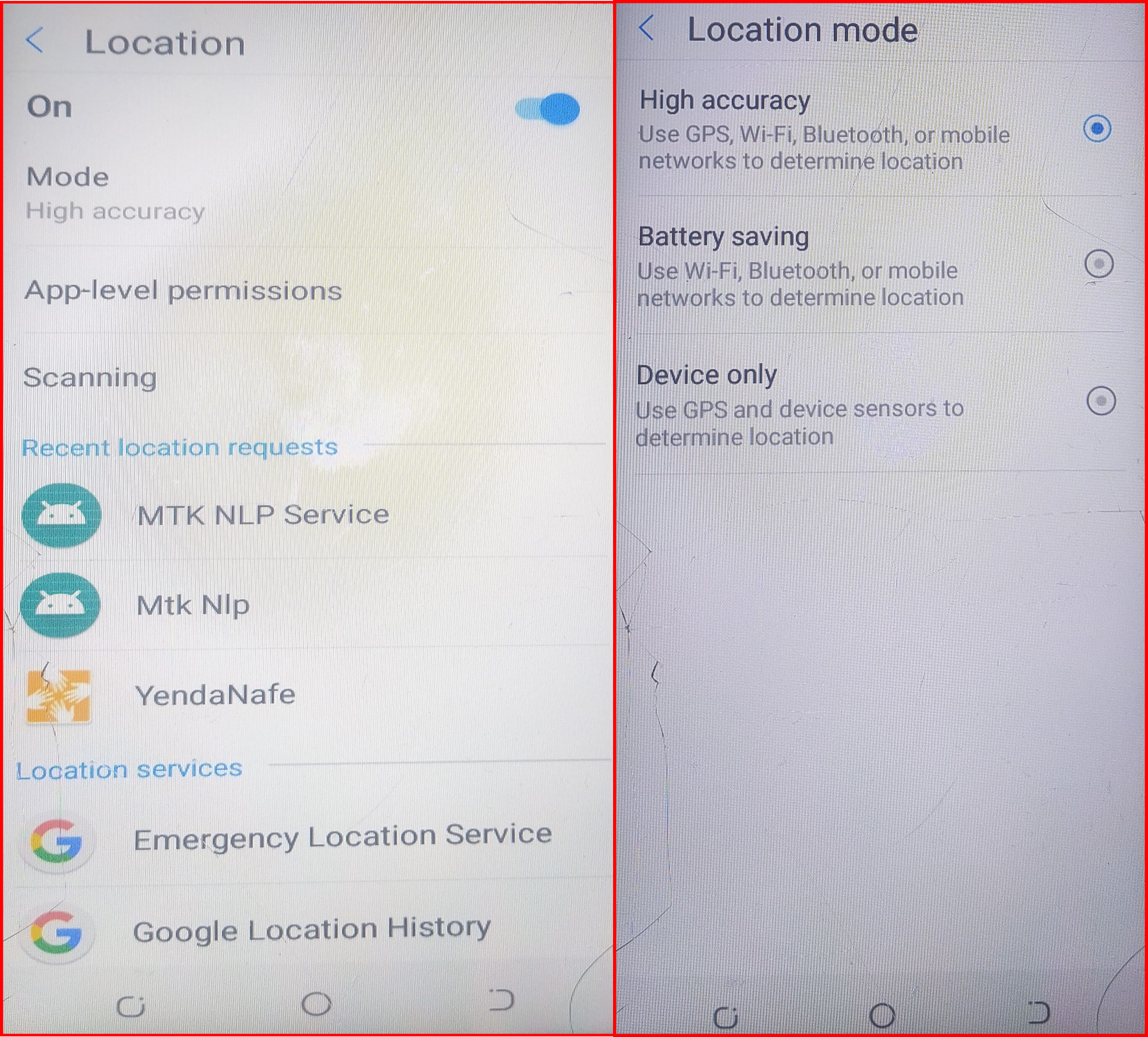
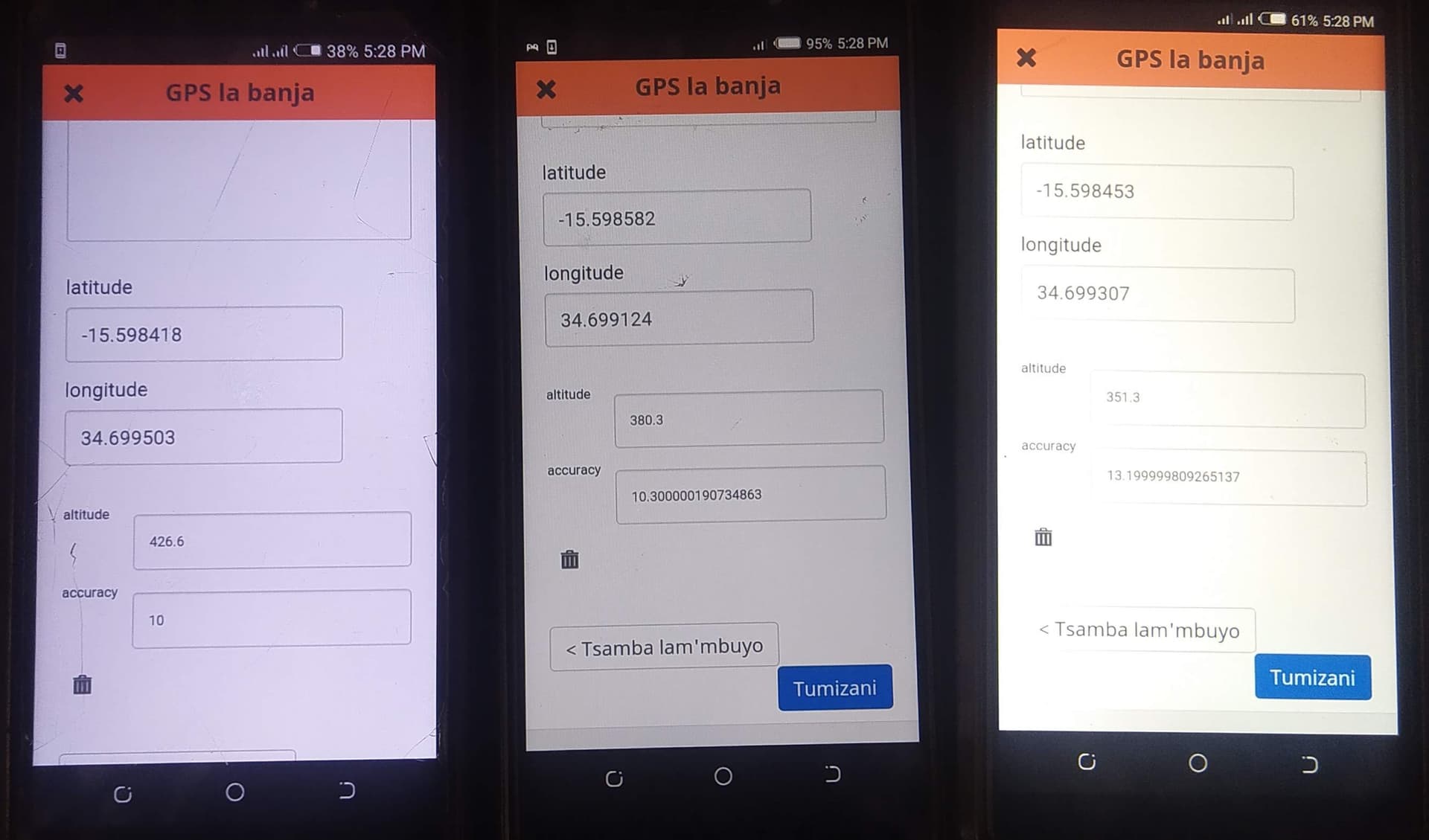
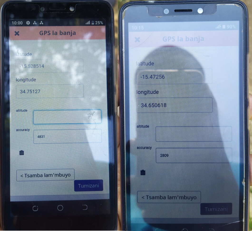
While troubleshooting on-site, only high accuracy mode produced a GPS location fix with a good level of accuracy (~10m). Some devices got an initial fix with poor accuracy of ~500m but this improved after resetting all radios by turning airplane mode on & off (see middle device before and after)
Initial location fix

After resetting
Device GPS hardware
The device models tested were:
- Tecno pop 2F
- Tecno pop 3
- Tecno pop 2 plus
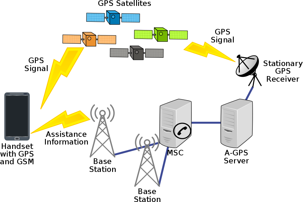
These devices are equipped with A-GPS (assisted GPS) hardware which is a Global Navigation Satellite System (GNSS) augmentation technology that relies on GPS data provided by the network operator via an A-GPS server that downloads and caches orbital information from GNSS satellites. An A-GPS capable device can connect to these servers and download GPS information using the GSM mobile network. This is usually categorized as data access and charged accordingly.
A-GPS system design:
Some A-GPS devices also include an autonomous GPS chipset for areas with low connectivity. We observed no GPS coordinates being collected on the Tecno models in the absence of a GSM connection. This means that the Tecno devices don’t have an autonomous GPS chipset installed and rely entirely on the service provider’s A-GPS implementation.
Autonomous GPS
GPS is one of the components of the satellite-based radionavigation system that comprises the Global Navigation Satellite Systems (GNSS). A complete list of GNSS deployments is:
- GPS - operated by the United States of America
- Galileo - operated by the European Union
- GLONASS - operated by the Russian Federation
- BeiDou - operated by the People’s Republic of China
- QZSS - operated by Japan
A few devices in some locations were able to get a location fix with very low accuracy which didn’t improve even after allowing up to 15 minutes for an improved fix:
Mitigation measures
- Sharing location data needs with the GSM service providers and government to highlight areas of improvement to the A-GPS infrastructure and possibly kickstart deployment of a ground-based GPS augmentation system for areas with low GSM connectivity.
- Replacing CHW devices with autonomous GPS in addition to A-GPS. Autonomous GPS support is labeled in the device specification in form of the supported GNSS system i.e. Galileo, GLONASS, BDS (BeiDou) or QZSS. The higher the number of supported GNSS systems, the better chances that a device has to get a location fix.